
KMZ last updated Sat, 08 Oct 2022 23:52:33 GMT Source link
Category Archives: General Strong Weather Info
POTENTIAL TROPICAL CYCLONE THIRTEEN
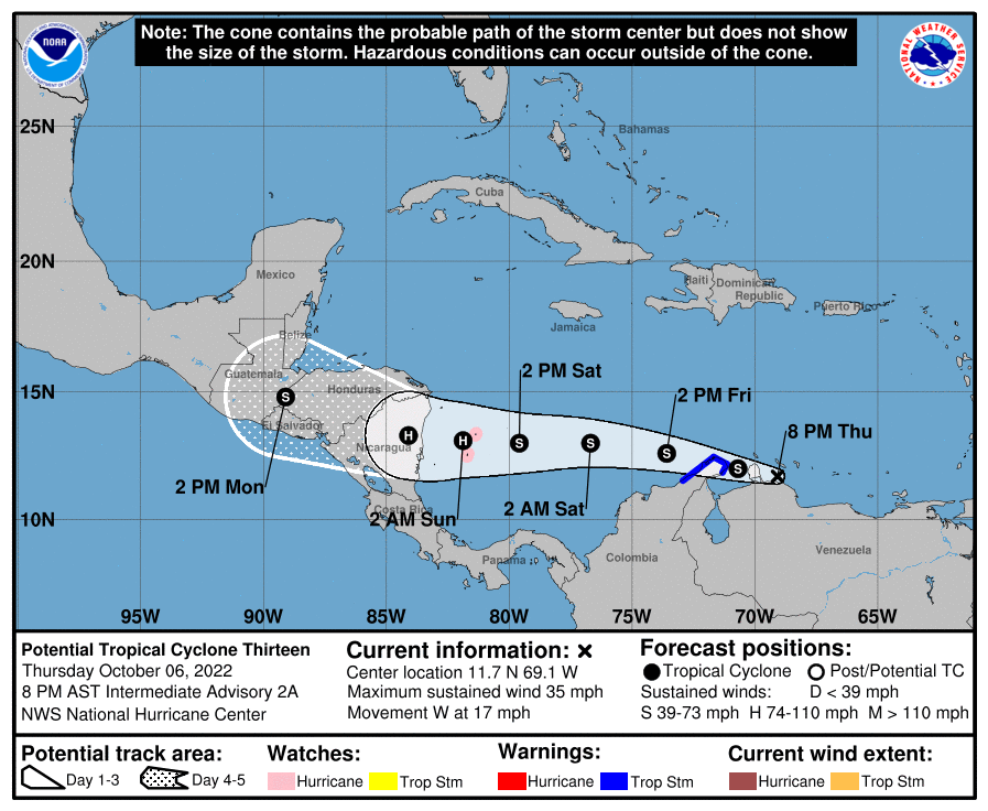
POTENTIAL TROPICAL CYCLONE THIRTEEN Coastal Watches/Warnings and Forecast Cone for Storm Center JavaScript/Active Scripting must be enabled to view other versions of this maps. * If the storm is forecast to dissipate within 3 days, the “Full Forecast” and “3 day” graphic will be identical Click Here for a 5-day Cone Printer Friendly Graphic How […]
Advisory #017 Forecast Track [kmz] – Hurricane Orlene (EP1/EP162022)
KMZ last updated Sun, 02 Oct 2022 20:37:16 GMT Source link
TROPICAL STORM ORLENE
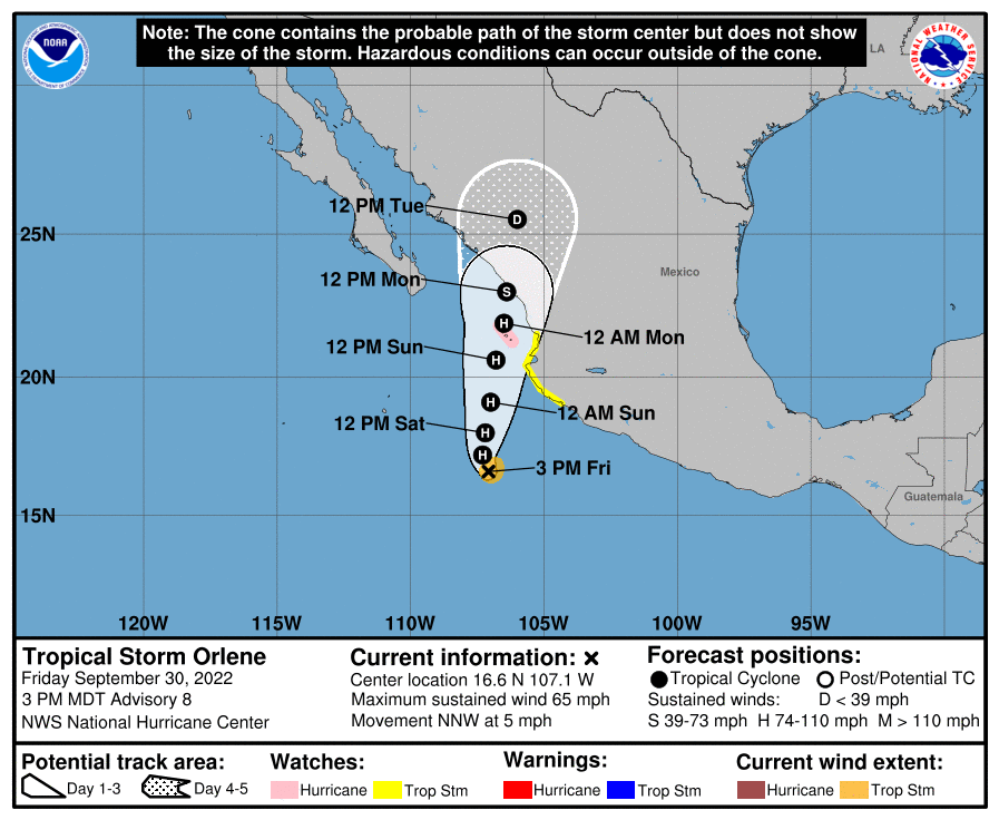
TROPICAL STORM ORLENE Coastal Watches/Warnings and Forecast Cone for Storm Center JavaScript/Active Scripting must be enabled to view other versions of this maps. * If the storm is forecast to dissipate within 3 days, the “Full Forecast” and “3 day” graphic will be identical Click Here for a 5-day Cone Printer Friendly Graphic How to […]
Hurricane Ian Public Advisory
000 WTNT34 KNHC 282057 TCPAT4 BULLETIN Hurricane Ian Advisory Number 25 NWS National Hurricane Center Miami FL AL092022 500 PM EDT Wed Sep 28 2022 …IAN BATTERING THE FLORIDA PENINSULA WITH CATASTROPHIC STORM SURGE, WINDS, AND FLOODING… …NEW WATCHES AND WARNINGS ISSUED FOR NORTH AND SOUTH CAROLINA… SUMMARY OF 500 PM EDT…2100 UTC…INFORMATION ———————————————- LOCATION…26.9N […]
Advisory #018 Forecast Track [kmz] – Tropical Storm Gaston (AT3/AL082022)
KMZ last updated Sat, 24 Sep 2022 21:10:23 GMT Source link
TROPICAL STORM NEWTON
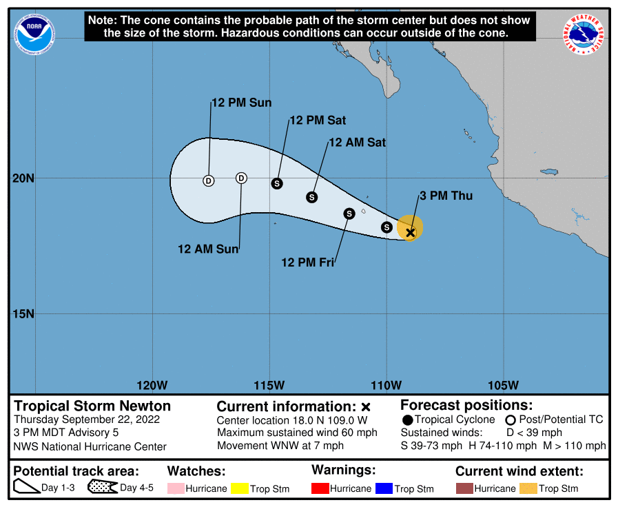
TROPICAL STORM NEWTON Coastal Watches/Warnings and Forecast Cone for Storm Center JavaScript/Active Scripting must be enabled to view other versions of this maps. * If the storm is forecast to dissipate within 3 days, the “Full Forecast” and “3 day” graphic will be identical Click Here for a 5-day Cone Printer Friendly Graphic How to […]
Hurricane Fiona Forecast Discussion
000 WTNT42 KNHC 202057 TCDAT2 Hurricane Fiona Discussion Number 26 NWS National Hurricane Center Miami FL AL072022 500 PM EDT Tue Sep 20 2022 Deep convection around Fiona’s eye is intense, but is in a rather asymmetrical pattern at this time. Upper-tropospheric outflow remains somewhat restricted over the western semicircle of the system. The last […]
Advisory #005 Forecast Track [kmz] – Tropical Storm Lester (EP3/EP132022)
KMZ last updated Fri, 16 Sep 2022 20:44:59 GMT Source link
Advisory #001 Forecast Track [kmz] – Tropical Depression Seven (AT2/AL072022)
KMZ last updated Wed, 14 Sep 2022 15:03:47 GMT Source link