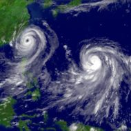
TROPICAL STORM PILAR


TROPICAL STORM PILAR


Coastal Watches/Warnings and Forecast Cone for Storm Center

cone graphic

* If the storm is forecast to dissipate within 3 days, the “Full Forecast” and “3 day” graphic will be identical

Click Here for a 5-day Cone Printer Friendly Graphic

How to use the cone graphic (video):

Link to video describing cone graphic

About this product:

This graphic shows an approximate representation of coastal areas under a hurricane warning (red), hurricane watch (pink),
tropical storm warning (blue) and tropical storm watch (yellow). The orange circle indicates the current position of the
center of the tropical cyclone. The black line, when selected, and dots show the National Hurricane Center (NHC) forecast track of the center
at the times indicated. The dot indicating the forecast center location will be black if the cyclone is forecast to be
tropical and will be white with a black outline if the cyclone is forecast to be extratropical. If only an L is displayed,
then the system is forecast to be a remnant low. The letter inside the dot indicates the NHC’s forecast intensity for that time:

D: Tropical Depression – wind speed less than 39 MPH
S: Tropical Storm – wind speed between 39 MPH and 73 MPH
H: Hurricane – wind speed between 74 MPH and 110 MPH
M: Major Hurricane – wind speed greater than 110 MPH

NHC tropical cyclone forecast tracks can be in error. This forecast
uncertainty is conveyed by the track forecast “cone”, the solid white
and stippled white areas in the graphic. The solid white area depicts
the track forecast uncertainty for days 1-3 of the forecast, while the
stippled area depicts the uncertainty on days 4-5. Historical data
indicate that the entire 5-day path of the center of the tropical
cyclone will remain within the cone about 60-70% of the time. To
form the cone, a set of imaginary circles are placed along the
forecast track at the 12, 24, 36, 48, 72, 96, and 120 h positions,
where the size of each circle is set so that it encloses 67% of the
previous five years official forecast errors. The cone is then formed
by smoothly connecting the area swept out by the set of circles.

It is also important to realize that a tropical cyclone is not a point. Their
effects can span many hundreds of miles from the center. The area
experiencing hurricane force (one-minute average wind speeds of at least
74 mph) and tropical storm force (one-minute average wind speeds of
39-73 mph) winds can extend well beyond the white areas shown enclosing
the most likely track area of the center. The distribution of hurricane
and tropical storm force winds in this tropical cyclone can be seen in
the Wind History graphic linked above.

Considering the combined forecast uncertainties in track, intensity, and size, the
chances that any particular location will experience winds of 34 kt (tropical storm force),
50 kt, or 64 kt (hurricane force) from this tropical cyclone are presented in

tabular form for selected locations and forecast positions
. This information is also presented in
graphical form for the 34 kt, 50 kt,
and 64 kt thresholds.

Note:  A detailed definition of the NHC track forecast cone is also available.


Source link

Tropical Storm Otis Forecast Discussion


000
WTPZ43 KNHC 240239
TCDEP3

Tropical Storm Otis Discussion Number   7
NWS National Hurricane Center Miami FL       EP182023
1000 PM CDT Mon Oct 23 2023

Otis has the appearance of a sheared tropical storm this evening, 
with the center on the eastern edge of a relatively new burst of 
deep convection.  The overall satellite intensity estimates still 
support an initial wind speed of 45 kt for this advisory.  Despite 
the shear, recent microwave data indicate that Otis has notable 
low-level structure, with a ring observed in 37 GHz microwave data. 
While this can be associated with rapid intensification, none of 
the models show that intensity change occurring, seemingly due to 
persistent moderate shear and some dry air in the mid-levels.  
Still, it makes sense to stay on the high side of the guidance given 
the structure and very warm SSTs in the path.  Thus, the new NHC 
forecast track is similar to the previous one, showing Otis near 
hurricane strength at landfall between 36-48 hours. 

Otis continues moving slowly north-northwestward at 6 kt in the flow
between a mid- to upper-level trough to its northwest and a ridge to
its east.   This flow will likely cause the storm to move to the 
north-northwest or northwest through landfall.  While most of the 
models respond by bringing Otis to the coast of southern Mexico on 
Wednesday, the GFS model remains an outlier and keeps Otis weaker 
and offshore.  The GFS solution seems very unlikely given the 
overall synoptic pattern, so the NHC track forecast will put little 
weight on its solution, keeping the official forecast about the same 
as the previous one, on the eastern side of the guidance envelope.

Key Messages:

1. Heavy rains from Otis will begin to impact areas of southwest
Mexico on Tuesday.  This rainfall will produce flash and urban
flooding, along with mudslides in areas of higher terrain.

2. Tropical storm conditions are expected and hurricane conditions
are possible beginning late Tuesday along portions of the southern
coast of Mexico, where a Tropical Storm Warning and Hurricane Watch
remain in effect.


FORECAST POSITIONS AND MAX WINDS

INIT  24/0300Z 13.6N  97.9W   45 KT  50 MPH
 12H  24/1200Z 14.4N  98.3W   50 KT  60 MPH
 24H  25/0000Z 15.5N  98.9W   55 KT  65 MPH
 36H  25/1200Z 16.4N  99.5W   60 KT  70 MPH
 48H  26/0000Z 17.3N 100.3W   50 KT  60 MPH...INLAND
 60H  26/1200Z 18.0N 101.0W   25 KT  30 MPH...POST-TROP/REMNT LOW
 72H  27/0000Z...DISSIPATED

$$
Forecaster Blake


Source link

Hurricane Tammy Forecast Discussion


000
WTNT45 KNHC 220259
TCDAT5

Hurricane Tammy Discussion Number  15
NWS National Hurricane Center Miami FL       AL202023
1100 PM AST Sat Oct 21 2023

Air Force and NOAA Hurricane Hunter aircraft data, along with radar
imagery from Guadeloupe, indicate that the center of Tammy passed
over the island of Barbuda a couple of hours ago.  The hurricane
continues to produce intense convection in a small CDO feature with
some ill-defined bands north and northeast of the center.  The
eyewall has generally not been closed on the radar images.  There
are still some areas of strong convection affecting portions of the
Lesser Antilles to the south of Tammy.  Flight-level and SFMR winds
along with Doppler velocity data suggested that the maximum winds 
had decreased slightly, but there was an unofficial report of a 
sustained wind of 78 kt from Barbuda.  Based on a blend of the 
aircraft data and the Barbuda observation, the intensity is held at 
75 kt for this advisory.

Center fixes indicate that the hurricane continues on its 
north-northwestward trek with an estimated motion of 330/9 kt. Over 
the next couple of days, Tammy should turn northward while it moves 
along the western side of a large subtropical high.  Then, the 
system should turn, at least temporarily, northeastward on the 
southeastern periphery of a mid-tropospheric trough over the western 
Atlantic.  Beginning around 3 days, the track forecast becomes 
challenging, since the global models indicate that the western 
Atlantic trough will bypass Tammy after 72 hours while it continues 
eastward.  A ridge could then build in to the northwest of the 
system and cause it to turn to the left.  As noted earlier, there is 
a very large spread in the track guidance in the latter part of the 
forecast period.  There is low confidence in the 4- and 5-day NHC 
forecast positions.

Tammy should remain over very warm waters with moderate vertical
wind shear for the next couple of days.  So, some slight 
strengthening is still forecast.  By 60 or 72 hours, increasing 
shear is likely to induce a weakening trend.  The official intensity 
forecast is similar to the latest Decay-SHIPS guidance.


KEY MESSAGES:

1.  Hurricane and tropical storm conditions are expected in portions
of the northern Leeward Islands through early Sunday.

2.  The heaviest rains from Tammy will continue over the Leeward
Islands through Sunday. This rainfall may produce isolated flash and
urban flooding, along with isolated mudslides in areas of higher
terrain.

3.  A storm surge could produce coastal flooding in areas of onshore
winds as the center of Tammy moves near or over the Leeward Islands.
Near the coast, the surge will be accompanied by large and dangerous
waves.


FORECAST POSITIONS AND MAX WINDS

INIT  22/0300Z 17.8N  61.9W   75 KT  85 MPH
 12H  22/1200Z 18.8N  62.5W   75 KT  85 MPH
 24H  23/0000Z 20.2N  63.4W   80 KT  90 MPH
 36H  23/1200Z 21.5N  63.9W   80 KT  90 MPH
 48H  24/0000Z 22.6N  63.8W   80 KT  90 MPH
 60H  24/1200Z 23.1N  63.6W   80 KT  90 MPH
 72H  25/0000Z 23.5N  63.0W   75 KT  85 MPH
 96H  26/0000Z 25.0N  62.5W   70 KT  80 MPH
120H  27/0000Z 27.5N  63.5W   60 KT  70 MPH

$$
Forecaster Pasch


Source link