Earthquake: 2024-11-11 00:49HKT M6.7 [19.79N, 77.01W] in Cuba Region http://openstreetmap.org/?mlat=19.79&mlon=-77.01.
Source link
Strong Earthquake Report M6.4 [46.70S, 75.24W] in Southern Chile (19:55 HKT 08/11/2024)
Earthquake: 2024-11-08 19:38HKT M6.4 [46.70S, 75.24W] in Southern Chile http://openstreetmap.org/?mlat=-46.7&mlon=-75.24.
Source link
Preliminary Best Track Points [kmz] – Hurricane Rafael (AT3/AL182024)
KMZ last updated Fri, 08 Nov 2024 20:35:31 GMT
Source link
Strong Earthquake Report M6.1 [4.87S, 153.27E] in New Ireland Region, Papua New Guinea (22:50 HKT 06/11/2024)
Earthquake: 2024-11-06 22:36HKT M6.1 [4.87S, 153.27E] in New Ireland Region, Papua New Guinea http://openstreetmap.org/?mlat=-4.87&mlon=153.27.
Source link
TROPICAL DEPRESSION FOURTEEN-E
Coastal Watches/Warnings and Forecast Cone for Storm Center
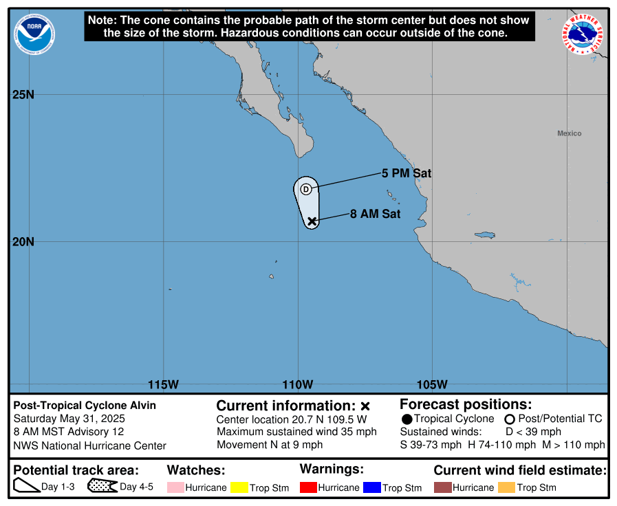
* If the storm is forecast to dissipate within 3 days, the “Full Forecast” and “3 day” graphic will be identical
Click Here for a 5-day Cone Printer Friendly Graphic
How to use the cone graphic (video):
About this product:
This graphic shows an approximate representation of coastal areas under a hurricane warning (red), hurricane watch (pink),
tropical storm warning (blue) and tropical storm watch (yellow). The orange circle indicates the current position of the
center of the tropical cyclone. The black line, when selected, and dots show the National Hurricane Center (NHC) forecast track of the center
at the times indicated. The dot indicating the forecast center location will be black if the cyclone is forecast to be
tropical and will be white with a black outline if the cyclone is forecast to be extratropical. If only an L is displayed,
then the system is forecast to be a remnant low. The letter inside the dot indicates the NHC’s forecast intensity for that time:
D: Tropical Depression – wind speed less than 39 MPH
S: Tropical Storm – wind speed between 39 MPH and 73 MPH
H: Hurricane – wind speed between 74 MPH and 110 MPH
M: Major Hurricane – wind speed greater than 110 MPH
NHC tropical cyclone forecast tracks can be in error. This forecast
uncertainty is conveyed by the track forecast “cone”, the solid white
and stippled white areas in the graphic. The solid white area depicts
the track forecast uncertainty for days 1-3 of the forecast, while the
stippled area depicts the uncertainty on days 4-5. Historical data
indicate that the entire 5-day path of the center of the tropical
cyclone will remain within the cone about 60-70% of the time. To
form the cone, a set of imaginary circles are placed along the
forecast track at the 12, 24, 36, 48, 72, 96, and 120 h positions,
where the size of each circle is set so that it encloses 67% of the
previous five years official forecast errors. The cone is then formed
by smoothly connecting the area swept out by the set of circles.
It is also important to realize that a tropical cyclone is not a point. Their
effects can span many hundreds of miles from the center. The area
experiencing hurricane force (one-minute average wind speeds of at least
74 mph) and tropical storm force (one-minute average wind speeds of
39-73 mph) winds can extend well beyond the white areas shown enclosing
the most likely track area of the center. The distribution of hurricane
and tropical storm force winds in this tropical cyclone can be seen in
the Wind History graphic linked above.
Considering the combined forecast uncertainties in track, intensity, and size, the
chances that any particular location will experience winds of 34 kt (tropical storm force),
50 kt, or 64 kt (hurricane force) from this tropical cyclone are presented in
tabular form for selected locations and forecast positions. This information is also presented in
graphical form for the 34 kt, 50 kt,
and 64 kt thresholds.
Note: A detailed definition of the NHC track forecast cone is also available.
TROPICAL DEPRESSION EIGHTEEN
Coastal Watches/Warnings and Forecast Cone for Storm Center
* If the storm is forecast to dissipate within 3 days, the “Full Forecast” and “3 day” graphic will be identical
Click Here for a 5-day Cone Printer Friendly Graphic
How to use the cone graphic (video):
About this product:
This graphic shows an approximate representation of coastal areas under a hurricane warning (red), hurricane watch (pink),
tropical storm warning (blue) and tropical storm watch (yellow). The orange circle indicates the current position of the
center of the tropical cyclone. The black line, when selected, and dots show the National Hurricane Center (NHC) forecast track of the center
at the times indicated. The dot indicating the forecast center location will be black if the cyclone is forecast to be
tropical and will be white with a black outline if the cyclone is forecast to be extratropical. If only an L is displayed,
then the system is forecast to be a remnant low. The letter inside the dot indicates the NHC’s forecast intensity for that time:
D: Tropical Depression – wind speed less than 39 MPH
S: Tropical Storm – wind speed between 39 MPH and 73 MPH
H: Hurricane – wind speed between 74 MPH and 110 MPH
M: Major Hurricane – wind speed greater than 110 MPH
NHC tropical cyclone forecast tracks can be in error. This forecast
uncertainty is conveyed by the track forecast “cone”, the solid white
and stippled white areas in the graphic. The solid white area depicts
the track forecast uncertainty for days 1-3 of the forecast, while the
stippled area depicts the uncertainty on days 4-5. Historical data
indicate that the entire 5-day path of the center of the tropical
cyclone will remain within the cone about 60-70% of the time. To
form the cone, a set of imaginary circles are placed along the
forecast track at the 12, 24, 36, 48, 72, 96, and 120 h positions,
where the size of each circle is set so that it encloses 67% of the
previous five years official forecast errors. The cone is then formed
by smoothly connecting the area swept out by the set of circles.
It is also important to realize that a tropical cyclone is not a point. Their
effects can span many hundreds of miles from the center. The area
experiencing hurricane force (one-minute average wind speeds of at least
74 mph) and tropical storm force (one-minute average wind speeds of
39-73 mph) winds can extend well beyond the white areas shown enclosing
the most likely track area of the center. The distribution of hurricane
and tropical storm force winds in this tropical cyclone can be seen in
the Wind History graphic linked above.
Considering the combined forecast uncertainties in track, intensity, and size, the
chances that any particular location will experience winds of 34 kt (tropical storm force),
50 kt, or 64 kt (hurricane force) from this tropical cyclone are presented in
tabular form for selected locations and forecast positions. This information is also presented in
graphical form for the 34 kt, 50 kt,
and 64 kt thresholds.
Note: A detailed definition of the NHC track forecast cone is also available.
Advisory #016 Forecast Track [kmz] – Hurricane Kristy (EP2/EP122024)
KMZ last updated Fri, 25 Oct 2024 14:40:52 GMT
Source link
Strong Earthquake Report M6.1 [49.67N, 155.23E] near Kuril Islands (22:49 HKT 23/10/2024)
Earthquake: 2024-10-23 22:38HKT M6.1 [49.67N, 155.23E] near Kuril Islands http://openstreetmap.org/?mlat=49.67&mlon=155.23.
Source link
HURRICANE KRISTY
HURRICANE KRISTY
Coastal Watches/Warnings and Forecast Cone for Storm Center
* If the storm is forecast to dissipate within 3 days, the “Full Forecast” and “3 day” graphic will be identical
Click Here for a 5-day Cone Printer Friendly Graphic
How to use the cone graphic (video):
About this product:
This graphic shows an approximate representation of coastal areas under a hurricane warning (red), hurricane watch (pink),
tropical storm warning (blue) and tropical storm watch (yellow). The orange circle indicates the current position of the
center of the tropical cyclone. The black line, when selected, and dots show the National Hurricane Center (NHC) forecast track of the center
at the times indicated. The dot indicating the forecast center location will be black if the cyclone is forecast to be
tropical and will be white with a black outline if the cyclone is forecast to be extratropical. If only an L is displayed,
then the system is forecast to be a remnant low. The letter inside the dot indicates the NHC’s forecast intensity for that time:
D: Tropical Depression – wind speed less than 39 MPH
S: Tropical Storm – wind speed between 39 MPH and 73 MPH
H: Hurricane – wind speed between 74 MPH and 110 MPH
M: Major Hurricane – wind speed greater than 110 MPH
NHC tropical cyclone forecast tracks can be in error. This forecast
uncertainty is conveyed by the track forecast “cone”, the solid white
and stippled white areas in the graphic. The solid white area depicts
the track forecast uncertainty for days 1-3 of the forecast, while the
stippled area depicts the uncertainty on days 4-5. Historical data
indicate that the entire 5-day path of the center of the tropical
cyclone will remain within the cone about 60-70% of the time. To
form the cone, a set of imaginary circles are placed along the
forecast track at the 12, 24, 36, 48, 72, 96, and 120 h positions,
where the size of each circle is set so that it encloses 67% of the
previous five years official forecast errors. The cone is then formed
by smoothly connecting the area swept out by the set of circles.
It is also important to realize that a tropical cyclone is not a point. Their
effects can span many hundreds of miles from the center. The area
experiencing hurricane force (one-minute average wind speeds of at least
74 mph) and tropical storm force (one-minute average wind speeds of
39-73 mph) winds can extend well beyond the white areas shown enclosing
the most likely track area of the center. The distribution of hurricane
and tropical storm force winds in this tropical cyclone can be seen in
the Wind History graphic linked above.
Considering the combined forecast uncertainties in track, intensity, and size, the
chances that any particular location will experience winds of 34 kt (tropical storm force),
50 kt, or 64 kt (hurricane force) from this tropical cyclone are presented in
tabular form for selected locations and forecast positions. This information is also presented in
graphical form for the 34 kt, 50 kt,
and 64 kt thresholds.
Note: A detailed definition of the NHC track forecast cone is also available.
Tropical Storm Oscar Forecast Discussion
322 WTNT41 KNHC 211445 TCDAT1 Tropical Storm Oscar Discussion Number 10 NWS National Hurricane Center Miami FL AL162024 1100 AM EDT Mon Oct 21 2024 Surface observations and visible satellite imagery indicate that the center of Oscar, although not very easy to locate, is still moving over eastern Cuba this morning. Radar observations from Guantanamo Bay show that the inner core of the tropical cyclone has become severely disrupted. The system has continued to weaken while interacting with the very mountainous terrain, and the initial wind speed is estimated to have decreased to near 35 kt, although this may be generous. The initial motion is an uncertain 300/3 kt. It is possible that the center of the system may re-form near the northern coast of Cuba later today. In any event, Oscar is expected to turn northward and northeastward on the eastern side of a mid-level trough over the western Bahamas through tonight. The system should then accelerate northeastward over portions of the southeastern Bahamas and western Atlantic ahead of the aforementioned trough. Global model predictions show the circulation of Oscar becoming absorbed by a larger, developing non-tropical low pressure area to the west of Bermuda by day 3. The NHC track forecast is similar to the previous one and is very close to the dynamical model consensus. Some additional weakening is expected while Oscar continues to interact with the land mass of eastern Cuba today, and Oscar could weaken to a tropical depression before the circulation moves over water. Thereafter, the system will be contending with increasing westerly vertical wind shear and drier air. Therefore only slight restrengthening is anticipated within the next day or so, followed by little change in strength before Oscar becomes absorbed by the non-tropical low pressure system. The primary hazard associated with Oscar will continue to be heavy rainfall and life-threatening flash flooding, particularly over the mountainous terrain of eastern Cuba. Preliminary reports in the Province of Guantanamo in eastern Cuba already indicate more than 10 inches of rain have fallen in spots. Key Messages: 1. Through midweek, heavy rainfall from Oscar will lead to areas of significant, life-threatening flash flooding along with mudslides across portions of eastern Cuba, especially within the Sierra Maestra. In addition, localized flash flooding will be possible across the southeastern Bahamas. 2. Tropical storm conditions are expected to continue today across portions of eastern Cuba. Tropical storm conditions are also expected in portions of the southeastern Bahamas tonight and Tuesday. FORECAST POSITIONS AND MAX WINDS INIT 21/1500Z 20.3N 75.4W 35 KT 40 MPH...INLAND 12H 22/0000Z 21.0N 75.3W 35 KT 40 MPH...OVER WATER 24H 22/1200Z 22.2N 74.7W 40 KT 45 MPH 36H 23/0000Z 23.7N 73.2W 40 KT 45 MPH 48H 23/1200Z 25.6N 71.2W 40 KT 45 MPH 60H 24/0000Z 28.3N 68.3W 40 KT 45 MPH 72H 24/1200Z...ABSORBED BY NON-TROPICAL LOW PRESSURE AREA $$ Forecaster Pasch/Delgado