Atlantic Tropical Weather Discussion


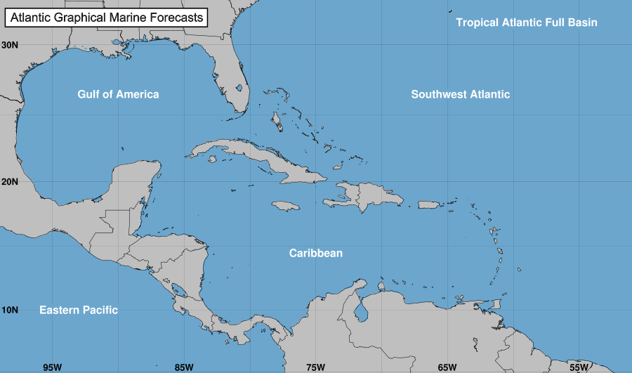
000
AXNT20 KNHC 060935
TWDAT 

Tropical Weather Discussion
NWS National Hurricane Center Miami FL
535 AM EDT Mon May 6 2019

Tropical Weather Discussion for North America, Central America
Gulf of Mexico, Caribbean Sea, northern sections of South
America, and Atlantic Ocean to the African coast from the
Equator to 32N. The following information is based on satellite
imagery, weather observations, radar and meteorological analysis.

Based on 0600 UTC surface analysis and satellite imagery through 
1045 UTC.

...MONSOON TROUGH/ITCZ...

The monsoon trough extends from the coast of Sierra Leone near
09N13W to 02N20W. The ITCZ continues from 02N20W to 01S30W to the
coast of Brazil near 01S45W. Widely scattered moderate convection
is from 01N-05N between 14W-22W. Isolated moderate convection is 
from 04N-06S between 23W-50W. 

GULF OF MEXICO...

A cold front extends from N Florida near 31N83W to the central 
Gulf of Mexico near 25N90W to S Texas near 26N97W. Scattered 
moderate convection is within 60 nm of the front. A surface trough
extends from the SE Gulf near 23N90W to Guatemala near 16N92W. 
Scattered moderate to isolated strong convection is from 15N-24N 
between 86W-93W. Isolated moderate convection is also over he
Florida Keys and S Florida. In the upper levels, a trough is over
the western Gulf enhancing convection. 

The cold front will weaken and drift southward today. A ridge 
will build northeast of the region through mid week. A trough over
the Yucatan Peninsula will support pulses of fresh to locally 
strong winds in the SW Gulf through Thu. Smoke and haze from 
ongoing agricultural fires in Mexico could reduce visibilities in 
the western Gulf and the Bay of Campeche. 

CARIBBEAN SEA...

15-25 kt tradewinds are over the Caribbean Sea with strongest
winds along the coast of N Colombia. Scattered moderate to
isolated strong convection is over the Yucatan Peninsula, Belize,
Guatemala, the Gulf of Honduras, and W Honduras. Widely scattered
moderate convection is also over N Colombia. In the upper levels,
a ridge is over the Caribbean with upper level moisture.

The gradient between high pressure northeast of the region near 
28N56W and low pressure in Colombia will support fresh to strong 
easterly winds in the south-central Caribbean and the Gulf of 
Honduras through Tue. Smoke and haze from ongoing agricultural 
fires could reduce visibilities north of Honduras. 

ATLANTIC OCEAN...

A 1022 mb high is centered over the central Atlantic near 27N55W.
A cold front extends across the eastern Atlantic from 31N22W to 
28N25W to 28N32W. A 1021 mb high is centered over the E Atlantic 
near 32N16W.

High pressure centered near 27N55W will shift eastward and weaken
through Tue. A weakening cold front will move into the northern 
waters tonight and continue southward through Tue. High pressure 
will build north of the region Wed through Thu night. 

For additional information please visit 
http://www.hurricanes.gov/marine

$$
Formosa


Source link

NHC Audio Briefings (Podcasts)


NHC Audio Briefings (Podcasts)


In an effort to provide users with additional information to
enhance planning and preparedness decisions, NHC provides
Audio Briefings (also called podcasts), when the media pool is
activated by the NHC Public Affairs Officer. In general, the
media pool is activated by NHC when a hurricane watch is
initiated for a portion of the United States coastline. The
audio briefings will provide the latest information regarding the
hurricane threat and its expected impacts.

When a current podcast is available, a link to the RSS/Podcast feed and a link to the corresponding directory with the latest
audio (mp3) file will be displayed. You can right-click and choose “save” to download the file.

Once the podcasts are older than 4 hours, they will not be shown on this page. If you have comments about this service,
please send us email or
complete a short survey.

Podcast Archive


– No podcast currently available –


XML logo
RSS Users – Subscribe to Podcast Feed:

http://www.nhc.noaa.gov/audio/podcast.xml


Source link

NHC Data in GIS Formats


NHC Data in GIS Formats


Data & Products

Please note these GIS datasets are provided as a convenience to users. Support for these data may not always be available or timely in nature. For issues directly related to the datasets below, please contact us.

† Dataset in shapefile format only (delivered as a .zip file)

‡ Dataset in shapefile and kml/kmz formats

* Probabilistic Storm Surge is available when U.S. Hurricane Watches/Warnings are in effect

‡• Wind Speed Probabilities (WSP)

This dataset is available in shapefile and kml/kmz formats.

The wind speed probabilities data also can be found through the National Digital Forecast Database (NDFD) at the following locations:

Technical information on accessing and using NDFD elements can be found at https://graphical.weather.gov/docs/datamanagement.php.

Additional Resources

To see other National Weather Service data available in GIS formats, please visit www.weather.gov/gis.


The NOAA Ocean Service’s nowCOAST project provides real-time links to many of these GIS datasets via WMS.
More information on accessing these data is available here.

NOAA’s Office for Coastal Management maintains a detailed online interactive mapping tool called Historical Hurricane Tracks at coast.noaa.gov/digitalcoast/tools/hurricanes.html. This tool offers users the ability to search and display global tropical cyclone data. The information can also be downloaded in widely-used GIS data formats.

When using the Historical Hurricane Tracks tool, the left side bar allows you to query storms by their location, name, year, etc. Search options can easily be refineed for the storm (or storms) that are of interest to the user. Please note that the Historical Hurricane Tracks interface will not contain data for the current season until the storms have had their entire datasets analyzed. For example, the 2011 season should be online by early 2012.

Another good source of vulnerability maps and GIS data is NOAA’s Digital Coast.
This website provides data required by coastal resource management professionals, as well as the tools, training, and information needed to turn these data into useful information.

Links


Source link

9-day weather forecast


Print Version
7-day Weather Forecast RSS

Full Version / Simplified Version

General Situation:


The trough of low pressure affecting southern China will move to the northern part of the South China Sea and weaken tomorrow. The easterly airstream over the coast of Guangdong will strengthen and showers will ease off in the latter part of this week. Another trough of low pressure is expected to develop over southern China early next week. The weather will become unsettled with thundery showers over the region.


01 May
(WED)

02 May
(THU)

03 May
(FRI)

04 May
(SAT)

05 May
(SUN)

06 May
(MON)

07 May
(TUE)

08 May
(WED)

09 May
(THU)

Rain


Mainly cloudy with occasional showers and squally thunder-storms. Showers will ease off gradually during the day.


Light Rain


Mainly cloudy with a few showers. Isolated thunder-storms at first.


SUNNY INTERVALS


Sunny intervals.


Cloudy


Mainly cloudy with one or two rain patches.


Light Rain


Mainly cloudy with a few showers.


Light Rain


Cloudy with a few showers and isolated thunder-storms.


Rain


Cloudy with showers and squally thunder-storms.


Rain


Cloudy with showers and squally thunder-storms.


Light Rain


Mainly cloudy with a few showers.


01 May
(WED)

02 May
(THU)

03 May
(FRI)

04 May
(SAT)

05 May
(SUN)

06 May
(MON)

07 May
(TUE)

08 May
(WED)

09 May
(THU)


Updated at: 16:30 HKT 30 Apr 2019

(Next update at: 11:30 HKT 1 May 2019)


Automatic Regional Weather Forecast in Hong Kong & Pearl River Delta Region


Climatological information for 01 May – 09 May

Sea surface temperature
2 p.m. on 30 Apr 2019 at North Point :

25 °C

Soil temperatures
7 a.m. on 30 Apr 2019 at the Hong Kong Observatory:

0.5m depth:26.5°C

1.0m depth:25.9°C


Note:

  1. This middle 50% range (between 25th and 75th percentiles) is calculated based on the maximum/minimum temperature and relative humidity data within a 5-day period centred on that day in the 30 years from 1981 to 2010.
  2. “9-day Weather Forecast” provides general indications of the trends in weather for the coming 9 days.
    For detailed description of today’s weather forecast, please refer to “Local Weather Forecast”.
  3. The accuracy of forecast generally decreases with forecast period. The average accuracy of weather forecast for the next one to three days, four to seven days, and eight to nine days are about 90%, 85% and 80% respectively.
  4. The accuracy of forecast also varies for different weather systems in different seasons. Generally speaking, weather in spring and summer such as fog, tropical cyclone and severe convective weather is more changeable, resulting in higher uncertainty of forecast.


Source link

National Hurricane Center


Source link

Local Weather Forecast


Here is the latest weather bulletin issued by the Hong Kong Observatory.

A fresh to strong easterly airstream is affecting the coastal areas of Guangdong. Meanwhile, the upper-air disturbance is bringing showers to southern China.

Weather forecast for this afternoon and tonight

Mainly cloudy with a few showers. Moderate to fresh easterly winds.

Outlook : Hot with sunny periods tomorrow. The weather will be unsettled midweek this week.


Source link